Parcellations#
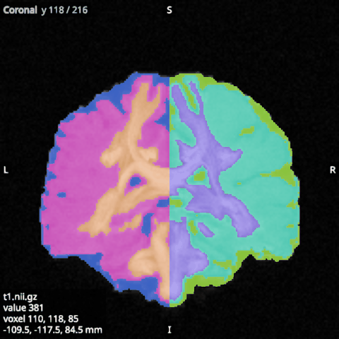
A parcellation, such as an atlas or FreeSurfer’s aparc+aseg, is an image of whole numbers, one per region,
with 0 outside every region. Open it as an overlay and tick Labels in its options: each region then
gets its own colour, and 0 is transparent, so the anatomy shows around the regions.
Colours#
Without a lookup table, the regions get built-in colours spread around the colour wheel, so that neighbouring numbers look different.
A lookup table names each region and gives its colour. Choose its file with Browse… beside Lookup table, or type its path; clear the field to go back to the built-in colours. Two layouts are read:
FreeSurfer’s,
index name R G B A, as inFreeSurferColorLUT.txt;MRtrix’s,
index short-name long-name R G B A, as infs_default.txt.
Colours are from 0 to 255, and the last column is ignored. A region missing from the table keeps its built-in colour.
An image with more distinct values than labels can show (8192) is drawn through its colormap instead, with a warning in the log.
Labels in 3D#
In the 3D view, chosen labels are drawn as surfaces in their colours. Press Choose labels in the overlay’s options: the Labels panel opens on the left and lists the labels in the image with their numbers, names and colours. Tick the ones to show, or type in the search field (a number or part of a name) and use All or None on the labels it finds. None are shown at first, so a parcellation costs nothing in 3D until labels are chosen; each label’s surface is computed once, in the background, the first time it is shown. The Labels panel (Ctrl+3) shows the selected overlay, and keeps the last one while another kind of item is selected. Closed or auto-hidden, it keeps its search and scroll position for when it opens again. Surface (under 3D) turns them all off and on again, and Opacity (3D) makes them see-through. The slices are not affected.